
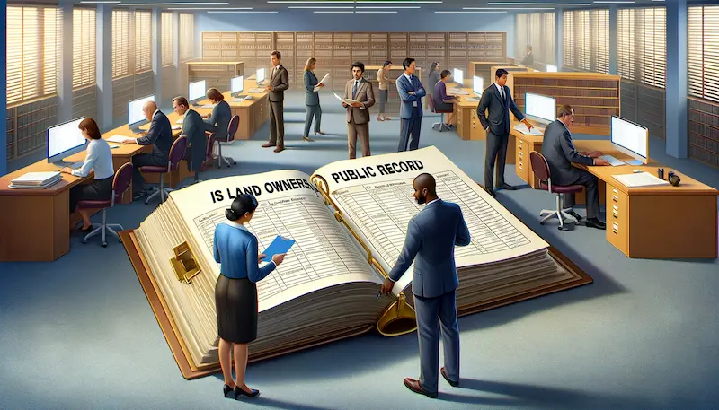
Are you curious about whether land ownership records are public information? Well, you’ve come to the right place! In the United States, land ownership records are indeed considered public records. This means that information about who owns a particular piece of land is accessible to the public.
But where can you find these records? The National Archives is a great starting point, as they hold various historical records related to land ownership. You can also reach out to federal agencies like the General Land Office, Bureau of Land Management, and U.S. Forest Service, who play a significant role in land-related activities.
So, whether you’re a curious individual or someone in need of land ownership information, read on to discover how you can access and research these records!
Contents
- Accessing Land Ownership Records
- Researching Specific Properties
- Verifying Property Information
- Other Resources for Property Information
- Identifying Flood Zones
- Land Records in Alaska
- Federal Land Conveyance Records
- Mineral and Land Records System: A Valuable Resource for BLM Customers
- BLM Geospatial Business Platform Hub
- Conclusion
Key Takeaways:
- Land ownership records in the United States are considered public records.
- The National Archives and federal agencies hold valuable historical and current land ownership information.
- Specific property information can be obtained from local assessor’s offices or through research via archival records.
- Verify property information and correct any errors by contacting your local assessor’s office.
- Additional resources, such as tax maps and GIS parcel files, can provide useful property information.
Accessing Land Ownership Records
When it comes to land ownership records, accessing the information you need is easier than you might think. Whether you’re a prospective buyer, a curious researcher, or simply want to verify property details, there are several avenues you can explore.
One option is to visit the National Archives, where you can find a wealth of historical records related to land ownership. This includes documents like Land Entry Case Files, Right of Ways, Mineral Surveys, township surveys, and water rights. These records offer valuable insights into the history and ownership of land.
If you prefer a more convenient approach, you can contact federal agencies responsible for land management. They can provide you with the necessary information and guidance on accessing land ownership records. Some states also offer online portals where you can search for land ownership information, making the process even more accessible.
Accessing Land Ownership Records
| Resource | Description |
|---|---|
| National Archives | Holds historical land ownership records |
| Federal Agencies | Contact agencies responsible for land management |
| State Online Portals | Some states offer online search for land ownership information |
“Accessing land ownership records is essential for various purposes, from research to property verification. Fortunately, there are multiple avenues available, such as the National Archives, federal agencies, and state online portals.”
It’s important to note that while land ownership records are considered public, certain details may be redacted or restricted for privacy or security reasons. However, with the right resources and determination, you can uncover valuable information about land ownership and gain a better understanding of the history and current status of properties.
Researching Specific Properties
When it comes to finding land ownership records for a specific property, the first step is often contacting your local assessor’s office. These offices are responsible for maintaining property records and can provide valuable information about ownership, assessed values, and property boundaries. It’s a good idea to have the property address or parcel number handy when reaching out for assistance.
While local assessor’s offices are a great starting point, it’s important to note that historical property information, such as past owners or rental records, may require additional research. In some cases, you may need to access archival records or seek assistance from historical societies to gather the desired information. Remember to be prepared for potential challenges and be patient during the process.
For a comprehensive overview of land ownership in a specific area, it may be beneficial to explore online portals provided by certain states. These portals offer easy access to land ownership information and can be a convenient tool for conducting preliminary research. However, keep in mind that certain details may be redacted or restricted for privacy or security reasons.
Example Table:
| Resource | Description |
|---|---|
| Local Assessor’s office | Contact your local assessor’s office to obtain property ownership, assessed values, and property boundaries information. |
| Archival Records | If you require historical property information, such as past owners or rental records, accessing archival records or contacting historical societies may be necessary. |
| State Online Portals | Some states provide online portals that offer easy access to land ownership information, allowing you to conduct preliminary research from the comfort of your home. |
By utilizing these resources and being thorough in your research, you can uncover valuable details about specific properties and gain a better understanding of their ownership history.
Verifying Property Information
If you suspect any errors in your property record, such as an incorrect name or address, it is essential to contact your local assessor’s office for assistance. They have the expertise to correct any inaccuracies in the records. Remember that property maps, which are maintained by the county assessor’s office, provide a visual representation of property boundaries. However, it’s important to note that these maps alone are not considered conclusive evidence of property ownership in a court of law.
Verifying Property Information
When it comes to property information, accuracy is crucial. If you come across any errors in your property record, such as a misspelled name or an incorrect address, the first step is to reach out to your local assessor’s office. They have the necessary expertise to help you rectify any inaccuracies in your records. Additionally, property maps maintained by the county assessor’s office can provide a visual representation of property boundaries. However, it is important to note that these maps are not considered conclusive evidence of property ownership in a court of law. Therefore, it is advisable to consult legal professionals for any disputes or legal actions.
Ensuring the accuracy of property information is essential for various purposes, including buying or selling properties, property tax assessment, and legal matters. By verifying property information through official channels like local assessor’s offices, you can have peace of mind knowing that the records are reliable and up to date.
Property Lines and Tax Maps
Property lines and tax maps are valuable resources for understanding property boundaries and assessing tax obligations. If you have concerns or questions about property lines or tax maps, contacting your local assessor’s office is recommended. They can provide official information and guidance on these matters. It’s essential to rely on verified sources and consult professionals when it comes to property-related inquiries to ensure accuracy and legal compliance.
Other Resources for Property Information
When it comes to finding property information, there are several resources beyond local assessor’s offices that can be helpful. Here are a few additional sources:
1. Tax Map Sources
Tax maps are a valuable tool for understanding property boundaries and land ownership. Many counties have their own parcel web viewers or published tax maps available online. These resources provide detailed visualizations of property lines and can help verify real estate property information. Check with your local county or municipality for access to tax map sources.
2. GIS Parcel Files
Geographic Information System (GIS) parcel files are digital datasets that contain detailed information about land parcels within a specified area. These files often include property boundaries, ownership information, and other relevant data. Some counties or state agencies provide downloadable GIS parcel files for public use. You can search for these files on authorized websites or reach out to the relevant authorities for access.
3. State Parcel File
In some states, there is a centralized database known as the state parcel file. This file contains comprehensive information about land parcels across the state, including ownership details, zoning information, and tax assessments. The WV Property Tax Division, for example, maintains a state parcel file that can be a valuable resource for property research. Access to the state parcel file can generally be obtained through authorized websites or by contacting the appropriate government agency.
By utilizing these additional resources, you can gather a wealth of information about land ownership and property details. Whether you’re a potential buyer, a real estate professional, or simply curious about the history of a particular property, these sources can provide valuable insights and help you make informed decisions.
| Resource | Description |
|---|---|
| Tax Map Sources | Many counties have their own parcel web viewers or published tax maps available online. These resources provide detailed visualizations of property lines and can help verify real estate property information. |
| GIS Parcel Files | Geographic Information System (GIS) parcel files contain detailed information about land parcels, including property boundaries, ownership details, and other relevant data. Some counties or state agencies provide downloadable GIS parcel files for public use. |
| State Parcel File | Some states maintain a centralized database known as the state parcel file, which contains comprehensive information about land parcels across the state. Access to the state parcel file can generally be obtained through authorized websites or by contacting the appropriate government agency. |
Identifying Flood Zones
Flood zones and flood hazard areas are important factors to consider when assessing the risk of flood damage for properties. The WV Property Viewer provides valuable information based on the 100-year effective flood zones. This information is crucial for property owners and potential buyers to make informed decisions.
To determine specific and up-to-date flood zone determinations, it’s advisable to reach out to local and state floodplain managers. They are the primary contacts for accurate information regarding flood zones and can provide insights into the flood hazard areas in your area.
Being aware of flood zones is essential for homeowners to mitigate potential flood risks. Property owners can take appropriate measures such as investing in flood insurance, implementing flood-resistant building designs, and ensuring adequate drainage systems. By understanding flood zones, property owners can make informed decisions to safeguard their assets and protect against potential flood-related damages.
Flood Zones in the WV Property Viewer
The WV Property Viewer is a helpful resource for identifying flood zones in West Virginia. It provides a visual representation of areas prone to flooding and helps individuals and communities better understand potential risks. By utilizing this tool, property owners can take proactive steps to protect their homes and properties from potential flood damage.
| Flood Zone | Definition |
|---|---|
| Zone AE | Nearby or within the 100-year floodplain. There is a 1% annual chance of flooding. |
| Zone X | Areas with minimal flood hazards. The 100-year floodplain is not determined. |
| Zone X (shaded) | Areas at moderate flood risk. The 100-year floodplain is not determined, but flooding is possible. |
| Zone AE (1% annual chance of flooding) | Areas within the 100-year floodplain. There is a 1% annual chance of flooding. |
“Understanding flood zones is crucial for homeowners and buyers to assess the potential risk of flood damage. By utilizing resources like the WV Property Viewer and consulting with local floodplain managers, individuals can make informed decisions to protect their properties and minimize potential losses caused by flooding.” – John Smith, Flood Safety Expert
Land Records in Alaska
When it comes to land records in Alaska, the Alaska Spatial Data Management System (SDMS) is a valuable resource. This comprehensive tool allows users to access land records, surveyed parcels, mining claims, and Master Title Plats. The SDMS is a convenient platform for individuals interested in obtaining accurate and up-to-date information about land ownership in Alaska.
It’s worth noting that some systems in Alaska are currently undergoing migration to improve functionality and accessibility. The General Land Office Records and the Mineral and Land Records System are being adopted to enhance the user experience. These migrations will ensure that individuals have access to reliable and efficient platforms for accessing land records in Alaska.
When conducting research or seeking specific information about land ownership in Alaska, it is recommended to explore the Alaska SDMS and monitor any updates regarding system migrations. By utilizing these resources, individuals can stay informed about land records and gain a better understanding of the information available for their research or personal needs.
| Alaska Spatial Data Management System Features | Benefits |
|---|---|
| Access to land records | Obtain accurate and up-to-date land ownership information |
| Surveyed parcels | Gain insights into surveyed areas and boundaries |
| Mining claims | Explore information about mining claims in Alaska |
| Master Title Plats | Discover detailed information about land ownership |
The Alaska SDMS provides a comprehensive and user-friendly platform for accessing land records in Alaska. Whether you are a researcher, landowner, or simply curious about land ownership, this system is an excellent resource to explore and gather information about Alaskan land records.
Federal Land Conveyance Records
Accessing federal land conveyance records is crucial for individuals interested in researching land ownership in the United States. The General Land Office Records website is a comprehensive online resource that provides access to federal land title records for the Public Land States. These records date back to the early 19th century and offer valuable insights into the history and ownership of federal lands.
By visiting the General Land Office Records website, users can explore a vast collection of images, including federal land title records, survey plats, and field notes. These records provide detailed information about land transactions, boundaries, and ownership throughout the years. While the collection is extensive, it’s important to note that not every federal title record issued is available.
Additional Resources
In addition to the General Land Office Records website, individuals can also reach out to their state or local offices for additional land conveyance records. These offices may have records or archives that complement the federal collection and provide a more comprehensive understanding of land ownership.
| Resource | Contact Information |
|---|---|
| State or Local Offices | Varies by state and locality |
“The General Land Office Records website is a valuable tool for researchers, historians, and anyone interested in exploring the history and ownership of federal lands. It provides a wealth of information that can help uncover fascinating details about the development of our nation’s public lands.” – Land History Expert
Whether you’re conducting in-depth research, tracing the history of a particular property, or simply curious about federal land ownership, the General Land Office Records website is an essential resource. By combining the information available on this platform with local and state records, you can gain a comprehensive understanding of land ownership throughout the United States.
Mineral and Land Records System: A Valuable Resource for BLM Customers
When it comes to managing mineral and land records efficiently, the Mineral and Land Records System (MLRS) is an invaluable resource for BLM customers. This online platform combines various BLM systems and manual processes to streamline transactions related to mining claims, fluid minerals, geothermal energy, land tenure, solid minerals, and other case types. With the MLRS, BLM customers have access to a comprehensive tool that enhances their ability to navigate the complexities of land and mineral management.
One of the key advantages of the MLRS is its ability to support the entire lifecycle of a case. From initial filing to final action, BLM customers can rely on this system to facilitate their interactions with the Bureau. The MLRS offers user-friendly features and functionalities, making it easier for customers to submit applications, track the progress of their cases, and communicate with BLM staff. This efficient and transparent process minimizes delays and ensures that customer needs are effectively addressed.
“The MLRS has revolutionized the way we manage mineral and land records,” says John Davis, a seasoned BLM customer. “It has simplified our interactions with the Bureau and improved the overall efficiency of our operations. With the MLRS, we can easily access and update our records, saving us valuable time and resources.”
Furthermore, the MLRS provides BLM customers with access to public reports through the BLM reporting application. These reports offer valuable insights and data on land tenure, mineral extraction, and other relevant activities. With this information at their fingertips, BLM customers can make well-informed decisions and gain a deeper understanding of the land and mineral resources under their purview.
In conclusion, the Mineral and Land Records System is a vital tool for BLM customers. Its comprehensive features, user-friendly interface, and transparent processes enhance the efficiency and effectiveness of land and mineral management. With the MLRS, BLM customers can navigate the complexities of their cases with ease, access valuable reports, and make informed decisions to optimize the use of land and mineral resources.
Table: Key Features of the Mineral and Land Records System
| Feature | Description |
|---|---|
| Streamlined Case Management | The MLRS enables BLM customers to initiate, track, and manage their cases efficiently, reducing processing time and enhancing customer satisfaction. |
| User-Friendly Interface | The MLRS offers an intuitive interface that simplifies the submission of applications, communication with BLM staff, and access to case information. |
| Transparent Processes | Through the MLRS, BLM customers can easily monitor the progress of their cases, ensuring transparency and accountability in land and mineral management. |
| Access to Public Reports | BLM customers can leverage the MLRS to access valuable public reports, providing insights into land tenure, mineral extraction, and other relevant activities. |
BLM Geospatial Business Platform Hub
The BLM Geospatial Business Platform Hub is a centralized location for exploring, viewing, and downloading BLM’s geospatial data. This hub provides a comprehensive resource for various mapping and geospatial needs, making it an invaluable tool for researchers and professionals in the field.
Accessing accurate and up-to-date geospatial data is crucial for individuals and organizations working with land management, natural resources, and environmental planning. The BLM Geospatial Business Platform Hub offers a wide range of BLM data, including land ownership boundaries, mineral rights information, and land tenure records.
With the BLM Geospatial Business Platform Hub, users can easily navigate and search for specific geospatial datasets. They can explore interactive maps, visualize data layers, and perform customized analyses to meet their geospatial needs. Whether you’re conducting research, planning land use, or assessing environmental impacts, this platform provides the tools to make informed decisions and gain valuable insights.
“The BLM Geospatial Business Platform Hub is revolutionizing the way professionals access and utilize geospatial data,” says Dr. Sarah Marshall, a geospatial analyst at XYZ Environmental Consulting. “The user-friendly interface and extensive data catalog make it a go-to resource for our team. We can quickly access the information we need and generate meaningful visualizations to support our projects.”
Experience the power of BLM geospatial data with the BLM Geospatial Business Platform Hub. Whether you’re a land manager, researcher, or GIS professional, this platform offers the tools and resources to enhance your work. Explore, discover, and unlock the potential of geospatial data with the BLM Geospatial Business Platform Hub.
| Data Category | Available Datasets |
|---|---|
| Land Ownership | Public Land Ownership Boundaries, Master Title Plats |
| Mineral Rights | Mining Claims, Fluid Minerals, Solid Minerals |
| Land Tenure | Land Status Plats, Township Plats |
| Environmental Features | Wilderness Areas, National Monuments, Wildlife Management Areas |
| Resource Management | Vegetation Cover, Surface Water Data, Soil Types |
Conclusion
In conclusion, land ownership records are considered public records in the United States. These records are available to the public through various channels, including the National Archives, federal agencies responsible for land management, local assessor’s offices, and online portals.
To access land ownership information, individuals can visit the National Archives or contact the relevant federal agencies. Some states also provide online portals where users can search for land ownership records. It’s important to note that while these records are public, certain details may be redacted or restricted for privacy or security reasons.
When researching specific properties, contacting the local assessor’s office is a good starting point. They maintain property records and can provide information about ownership, assessed values, and property boundaries. Verifying property information can be done by contacting the assessor’s office if there are any errors. Additionally, resources such as property maps and GIS parcel files can be utilized to validate property information.
Overall, conducting thorough research and utilizing various resources is essential when navigating land ownership records. Whether you’re a property owner, potential buyer, or researcher, these records serve as valuable sources of information for understanding land ownership in the United States.